L’Alpinisme

This page in EnglishENDiese Seite auf deutschDEĈi tiu paĝo en EsperantoEO

Version françaiseFR

Here I am at the summit of Hawksbill Mountain, Shenandoah National Park in Virginia, in April 2009.
Close
Here I am at the summit of Hawksbill Mountain, Shenandoah National Park in Virginia, in April 2009.18-Apr-2009 18:06, Canon Canon PowerShot G9, 4.0, 7.4mm, 0.003 sec, ISO 80
 

Laissez-moi être votre guide à l’alpinisme et à la nature!

L’Alpinisme

L’alpinisme est un de mes passe-temps preférés, et c’est facile à comprendre pourquoi.  C’est ma manière préférée m’échapper de la ennuie de la vie.  C’est une manière à avoir de l’air fraiche et une change de scène.  L’alpinisme a été pour moi aussi la base de quelques contactes amicables de beaucoup d’années.  Quand je fais la connaissance de gens des autres pays, je montre à eux ma région, et comme parte de ça nous allons aux montagnes et d’autres parties de nature.  Mes amis internationaux veulent explorer un pays nouveau, et j’aime bien montrer à eux ma region.  Pour la plupart, mes amis locales n’ont pas d’interesse dans ça.  J’ai fait le camping aussi quelques fois, mais je n’ai pas fait ça de longtemps.  J’ai fait les photos sur cette page pendant beaucoup d’années, de l’année 1996 jusqu’à maintenant.

Voici quelques voyages que j’ai fait avec mes amis des autres pays:

Fialka Grigorova at the top of Hawksbill Mountain, Shenandoah National Park in Virginia.  In front is a pot of coffee brewing.
Close
Fialka Grigorova at the top of Hawksbill Mountain, Shenandoah National Park in Virginia. In front is a pot of coffee brewing.18-Apr-2009 18:21, Canon Canon PowerShot G9, 4.0, 7.4mm, 0.017 sec, ISO 80
Fialka Grigorova, left, and myself, right, at the top of Hawksbill Mountain, Shenandoah National Park in Virginia, April 2009.
Close
Fialka Grigorova, left, and myself, right, at the top of Hawksbill Mountain, Shenandoah National Park in Virginia, April 2009.18-Apr-2009 18:07, Canon Canon PowerShot G9, 4.0, 7.4mm, 0.003 sec, ISO 80
 
Fialka Grigorova on the beach at Sandy Point State Park, with the Chesapeake Bay Bridge in the background, on the Chesapeake Bay near Annapolis.
Close
Fialka Grigorova on the beach at Sandy Point State Park, with the Chesapeake Bay Bridge in the background, on the Chesapeake Bay near Annapolis.26-Apr-2009 18:47, Canon Canon PowerShot G9, 2.8, 7.4mm, 0.017 sec, ISO 100
Fialka Grigorova at the summit of Stony Man Mountain, Shenandoah National Park in Virginia, April 2009.
Close
Fialka Grigorova at the summit of Stony Man Mountain, Shenandoah National Park in Virginia, April 2009.18-Apr-2009 15:44, Canon Canon PowerShot G9, 4.0, 7.4mm, 0.002 sec, ISO 100
 
My friend Peter Philip on the Chesapeake Bay, Elk Neck State Park, near North East, Maryland, near the border to Delaware.
Close
My friend Peter Philip on the Chesapeake Bay, Elk Neck State Park, near North East, Maryland, near the border to Delaware.21-Oct-2007 16:34, Canon Canon PowerShot G9, 8.0, 7.4mm, 0.004 sec, ISO 80
Tanja Vocke and I hiking through a crevice at Chimney Rock.
Close
Tanja Vocke and I hiking through a crevice at Chimney Rock.
 
My friends Bernd, Stefan, and Olli-Pekka.  At the summit of Hawksbill Mountain, October 1996.
Close
My friends Bernd, Stefan, and Olli-Pekka. At the summit of Hawksbill Mountain, October 1996.
Strolling through the forest in autumn, Catoctin Mountain Park in Thurmont, Maryland.
Close
Strolling through the forest in autumn, Catoctin Mountain Park in Thurmont, Maryland.
 

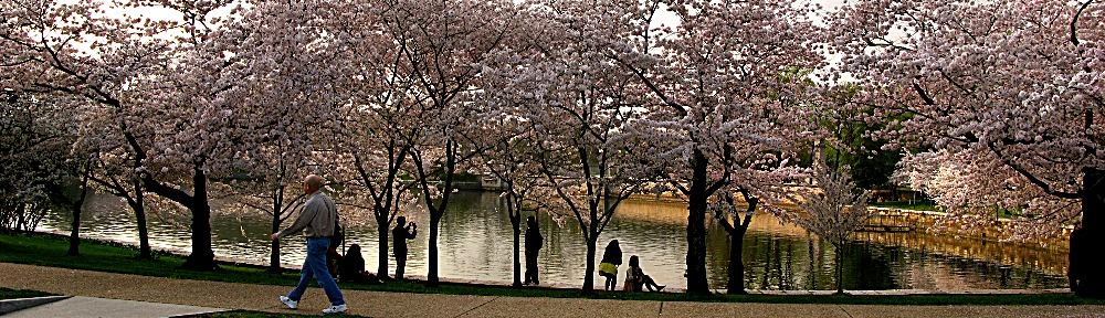
La première ligne, de gauche à droite: Fialka Grigorova sur la cime de Hawksbill Mountain, Shenandoah National Park dans Virginia; Fialka Grigorova et moi sur la cime de Hawksbill Mountain Summit.

La deuxième ligne, de gauche à droite: Fialka Grigorova sur la plage de Sandy Point State Park de Annapolis, Maryland; Fialka Grigorova sur Stony Man Mountain, Shenandoah National Park dans Virginia.

La troixème ligne: Peter Phillip sur la plage dans Elk Neck State Park, Cheseapeake Bay, Maryland; Tanja Vocke et moi sur Chimney Rock, Catoctin Park en Maryland.

La quatrième ligne: Bernd, Stefan, et Olli-Pekka sur la cime de Hawksbill Mountain; une promenade dans les bois, Catoctin Park en Maryland.

Les places naturelles dans ma regions se trouvent dans plusieurs categories…je vous invite regarder et explorer!

Parcs Locals

La terre dans mon quartier est tout en bas, et il y a de rivières et de forêts.  Il n y a pas beaucoup des montagnes, mais il y a des belles routes à promener que sont très prochaines et sont facile à trouver.  Dans Maryland, mon état domicile, il n y a pas de lacs dans la sense normale (il n y a pas de lacs naturals), mais il y a quelques reservoirs, et les rivières locales vont a ces reservoirs.  Quelques reservoirs ont des forêts, et il y a des routes dans les forêts que sont faciles et plaisants, et il vaut explorer.  Regardez ces places, et imaginez que vous êtes seulement quelques minutes de la ville.  J’ai passé beaucoup de journées sur cettes routes, et mon père m’a pris a elles quand j’étais enfant.  Great Falls Park est plus naturel, plus grand, et est un parc national que tient aussi la Potomac River et la Canale de Chesapeake et Ohio (C&O) a côté de la rivière.

Along a lakeside path.
Close
Along a lakeside path.29-May-2011 19:40, Canon Canon PowerShot G9, 4.0, 7.4mm, 0.006 sec, ISO 80
Gathering by the lake at sunset.
Close
Gathering by the lake at sunset.29-May-2011 19:36
Forest trail near Meadowside Nature Center in Rock Creek Park, Rockville, Maryland.
Close
Forest trail near Meadowside Nature Center in Rock Creek Park, Rockville, Maryland.
 
Lake Needwood at sunset, Rock Creek Park, Rockville, Maryland.
Close
Lake Needwood at sunset, Rock Creek Park, Rockville, Maryland.
Reflections, Lake Needwood, Rock Creek Park, Rockville, Maryland.
Close
Reflections, Lake Needwood, Rock Creek Park, Rockville, Maryland.
Rock Creek Park, the creek and bike path, near my house.
Close
Rock Creek Park, the creek and bike path, near my house.04-Apr-2009 15:46, Canon Canon PowerShot G9, 4.0, 9.855mm, 0.006 sec, ISO 80
 
Evergreens, Seneca Creek State Park near Gaithersburg, Maryland.
Close
Evergreens, Seneca Creek State Park near Gaithersburg, Maryland.22-Oct-2007 16:39, Canon Canon PowerShot G9, 4.0, 7.4mm, 0.013 sec, ISO 100
Lake Clopper, Seneca Creek State Park in Gaithersburg, Maryland.
Close
Lake Clopper, Seneca Creek State Park in Gaithersburg, Maryland.22-Oct-2007 14:52, Canon Canon PowerShot G9, 4.0, 7.4mm, 0.002 sec, ISO 80
One of the local residents of Seneca Creek State Park near Gaithersburg, Maryland.
Close
One of the local residents of Seneca Creek State Park near Gaithersburg, Maryland.22-Oct-2007 14:42, Canon Canon PowerShot G9, 4.8, 44.4mm, 0.004 sec, ISO 100
 
Great Falls, the rapids of the Potomac River, on the Maryland Side of the Maryland-Virginia border.
Close
Great Falls, the rapids of the Potomac River, on the Maryland Side of the Maryland-Virginia border.25-Oct-2007 02:50, Eastman Kodak Company Kodak CLAS Digital Film Scanner / HR200
Chesapeake and Ohio Canal and towpath, Great Falls Park, Maryland.
Close
Chesapeake and Ohio Canal and towpath, Great Falls Park, Maryland.25-Oct-2007 02:50, Eastman Kodak Company Kodak CLAS Digital Film Scanner / HR200
Great Falls Park in Maryland.
Close
Great Falls Park in Maryland.25-Oct-2007 02:50, Eastman Kodak Company Kodak CLAS Digital Film Scanner / HR200
 

La première ligne, de gauche à droite: Route à côté du lac, Black Hills Regional Park; on se rencontre pendant la couche de soleil, Black Hills Regional Park; Route dans le forêt, Meadowside Nature Center chez Rock Creek.

La deuxième ligne, de gauche à droite: Lake Needwood pendant la couche de soleil; Lake Needwood pendant la couche de soleil; Rock Creek Park.

La troixième ligne, de gauche à droite: Les arbres a feuilles persistantes, Seneca Creek State Park; Lake Clopper, Seneca Creek State Park; un des résidents de Seneca Creek State Park à côté de Lake Clopper.

La quatrième ligne, de gauche à droite: Great Falls Park-les rapides du Potomac River sur la frontière de Maryland et Virginia; Chesapeake and Ohio (C&O) Canal et la route de promenade dans Great Falls Park; Les rôches dans l’eau, Great Falls Park. .

Les Parcs dans les Montagnes

Ces parcs sont plus grands, plus sauvages, et plus distants.  Dans ma région, la plupart sont dans le nord et ouest de Maryland, et aussi dans l’état Virginia au sud de Maryland.  Pour la plupart ces parcs sont naturels, mais Rocky Gap State Park et Deep Creek Lake sont reservoirs que se cachent entre les montagnes de la partie oueste de Maryland, la partie le plus distant.  La Applachian Trail passe par beaucoup des parcs (la route que va de Maine jusqu’a Georgia), parce qu’elle passe par Maryland et Virginia.  Ces parcs sont mes parcs preférés et sont les plus spectaculaires.  Regardez cettes photos!

The summit of Sugarloaf Mountain, near Barnesville, Maryland.
Close
The summit of Sugarloaf Mountain, near Barnesville, Maryland.
View from the parking lot, Sugarloaf Mountain, near Barnesville, Maryland.
Close
View from the parking lot, Sugarloaf Mountain, near Barnesville, Maryland.
The first Washington Monument, built to honor George Washington.  Washington Monument State Park, Boonsboro, Maryland.
Close
The first Washington Monument, built to honor George Washington. Washington Monument State Park, Boonsboro, Maryland.22-Mar-2009 17:36, Canon Canon PowerShot G9, 4.0, 7.4mm, 0.004 sec, ISO 80
 
View from the old Washington Monument, Washington Monument State Park, near the Appalachian Trail in Boonsboro, Maryland.
Close
View from the old Washington Monument, Washington Monument State Park, near the Appalachian Trail in Boonsboro, Maryland.22-Mar-2009 17:20, Canon Canon PowerShot G9, 4.0, 12.733mm, 0.005 sec, ISO 80
Sun bursting through the clouds, Washington Monument State Park in Boonsboro, Maryland.
Close
Sun bursting through the clouds, Washington Monument State Park in Boonsboro, Maryland.22-Mar-2009 17:09, Canon Canon PowerShot G9, 5.6, 16.822mm, 0.001 sec, ISO 80
Panorama, Sky Meadows State Park, Virginia.
Close
Panorama, Sky Meadows State Park, Virginia.04-Nov-2007 16:52, Canon Canon PowerShot G9, 4.0, 25.033mm, 0.006 sec, ISO 80
 
Partly up the hill, Sky Meadows State Park, Virginia.
Close
Partly up the hill, Sky Meadows State Park, Virginia.04-Nov-2007 16:55, Canon Canon PowerShot G9, 4.0, 29.167mm, 0.006 sec, ISO 80
Stalagtites in Winter, Swallow Falls State Park, Western Maryland.
Close
Stalagtites in Winter, Swallow Falls State Park, Western Maryland.
Muddy Creek Falls, Swallow Falls State Park, Western Maryland.
Close
Muddy Creek Falls, Swallow Falls State Park, Western Maryland.
 
Swallow Falls, Swallow Falls State Park in Garrett County, Western Maryland.
Close
Swallow Falls, Swallow Falls State Park in Garrett County, Western Maryland.
Thick virgin forest in Swallow Falls State Park, Western Maryland.
Close
Thick virgin forest in Swallow Falls State Park, Western Maryland.
Trail on the ridge, Massanutten Mountain, George Washington National Forest, Virginia.
Close
Trail on the ridge, Massanutten Mountain, George Washington National Forest, Virginia.
 
Autumn colors at sunset, Green Ridge State Park in Western Maryland.
Close
Autumn colors at sunset, Green Ridge State Park in Western Maryland.
Autumn in Green Ridge State Forest in Western Maryland.
Close
Autumn in Green Ridge State Forest in Western Maryland.
Annapolis Rock, near the Appalachian Trail by Myersville, Maryland.
Close
Annapolis Rock, near the Appalachian Trail by Myersville, Maryland.
 
Weverton Cliffs in Maryland, by the Potomac River.
Close
Weverton Cliffs in Maryland, by the Potomac River.
Wolf Rock, Catoctin Mountain Park, near Thurmont, Maryland.
Close
Wolf Rock, Catoctin Mountain Park, near Thurmont, Maryland.
Chimney Rock, Catoctin Mountain Park near Thurmont, Maryland, in wintertime.
Close
Chimney Rock, Catoctin Mountain Park near Thurmont, Maryland, in wintertime.08-Mar-2009 16:19, Canon Canon PowerShot G9, 4.0, 7.4mm, 0.008 sec, ISO 100
 

La première ligne, de gauche à droite: De la cime de Sugarloaf Mountain dans Barnesville, Maryland; Vu de la vallée de la place de stationnement, Sugarloaf Mountain; La première Monument à President Washington, Washington Monument State Park en Boonsboro, Maryland.

La deuxième ligne, de gauche à droite: La cime du monument, Washington Monument State Park; Le soleil et les nubes, Washington Monument State Park; Panorama, Sky Meadows State Park dans Virginia.

La troixième ligne, de gauche à droite: Sur la montagne, Sky Meadows State Park dans Virginia; La glace, Swallow Falls State Park dans la partie oueste de Maryland; Muddy Creek Falls, Swallow Falls State Park dans la partie oueste de Maryland.

La quatrième ligne, de gauche à droite: Swallow Falls, Swallow Falls State Park; Le forêt vierge, Swallow Falls State Park; Massanutten Mountain, George Washington National Forest, Virginia.

La cinquième ligne, de gauche à droite: Les couleurs d’automne pendant la couche de soleil, Green Ridge State Forest dans la partie oueste de Maryland; La cime de la montagne, Green Ridge State Forest; Annapolis Rocks (près de la Appalachian Trail dans Maryland.

La sixième ligne, de gauche à droite: Weverton Cliffs, Potomac River, près de la Appalachian Trail dans Maryland; Wolf Rock, Catoctin State Park (près de Camp David, dans Maryland); Chimney Rock, Catoctin State Park.

La septième ligne: Rocky Gap State Park dans la partie oueste de Maryland.

Un des parcs, Shenandoah National Park dans Virginia, deserve d’attention speciale.  L’autoroute Skyline Drive va pour 170 km dans le parc, en haut et en bas.  La route est très longue, mais il vaut le temps à voir.  Regardez cettes images!

Sunset over Hawksbill Mountain, highest point in Shenandoah National Park in Virginia.
Close
Sunset over Hawksbill Mountain, highest point in Shenandoah National Park in Virginia.18-Apr-2009 18:47, Canon Canon PowerShot G9, 4.0, 7.4mm, 0.01 sec, ISO 100
Old Rag Mountain, Shenandoah National Park in Virginia.
Close
Old Rag Mountain, Shenandoah National Park in Virginia.18-Apr-2009 18:08, Canon Canon PowerShot G9, 4.5, 36.781mm, 0.005 sec, ISO 80
 
Sunset View from Hawksbill Mountain, the highest point in Shenandoah National Park in Virginia at 4050 ft (about 1350 meters).
Close
Sunset View from Hawksbill Mountain, the highest point in Shenandoah National Park in Virginia at 4050 ft (about 1350 meters).18-Apr-2009 18:44, Canon Canon PowerShot G9, 4.0, 7.4mm, 0.013 sec, ISO 400
View of Skyline Drive and the Blue Ridge from Stony Man Mountain, Shenandoah National Park in Virginia.
Close
View of Skyline Drive and the Blue Ridge from Stony Man Mountain, Shenandoah National Park in Virginia.
 
Near the summit of Stony Man Mountain, Shenandoah National Park in Virginia.
Close
Near the summit of Stony Man Mountain, Shenandoah National Park in Virginia.
Little Stony Man Cliffs, Stony Man Mountain, Shenandoah National Park in Virginia.
Close
Little Stony Man Cliffs, Stony Man Mountain, Shenandoah National Park in Virginia.
 
Big Meadows, just off Skyline Drive, Shenandoah National Park in Virginia.
Close
Big Meadows, just off Skyline Drive, Shenandoah National Park in Virginia.
Shenandoah River in Virginia.  Taken from Massanutten Mountain, George Washington National Forest, Virginia.
Close
Shenandoah River in Virginia. Taken from Massanutten Mountain, George Washington National Forest, Virginia.
 

La première ligne, de gauche à droite: la couche de soleil en derrière de Hawksbill Mountain, la cime la plus haute dans le parc (1350 metres); Old Rag Mountain; La vue de Hawksbill Mountain.

La deuxième ligne, de gauche à droite: La vue de Hawksbill Mountain; Skyline Drive de Little Stony Man Cliffs, Stony Man Mountain;

La troixième ligne, de gauche à droite: Les arbres sur la cime de Stony Man Mountain; Little Stony Man Cliffs.

La quatrième ligne, de gauche à droite: Isolation et desolation dans Big Meadows dans la partie centrale du parc. Remarquez: cette locale est à côté de Skyline Drive, mais on sens que c’est très loin de la civilisation; La vue de Shenandoah National Parc, et de la Rivière Shenandoah, de l’autre côté de la Vallée Shenandoah.

Parcs sur la Mer

Ces parcs sont totalement différents, ils sont dans la partie d’est de Maryland, et sont sur la mer et sont en bas.  Ils se trouvent sur le Chesapeake Bay, que divide Maryland Centrale de la partie d’est de Maryland, et sur la mer atlantique.  Je vais a ces parcs moins souventment, mais la change de la scène est bienvenue.  Regardez mes photos de ces parcs!

Sunset over the Chesapeake Bay Bridge, from Sandy Point State Park near Annapolis, Maryland (by the Chesapeake Bay).
Close
Sunset over the Chesapeake Bay Bridge, from Sandy Point State Park near Annapolis, Maryland (by the Chesapeake Bay).25-Apr-2009 18:41, Canon Canon PowerShot G9, 4.0, 7.4mm, 0.013 sec, ISO 200
Trees above the Chesapeake Bay, Elk Neck State Park, near North East, Maryland, near the border to Delaware.
Close
Trees above the Chesapeake Bay, Elk Neck State Park, near North East, Maryland, near the border to Delaware.21-Oct-2007 17:39, Canon Canon PowerShot G9, 4.0, 7.4mm, 0.004 sec, ISO 80
Turkey Point Lighthouse, Elk Neck State Park, near North East, Maryland, near the border to Delaware.
Close
Turkey Point Lighthouse, Elk Neck State Park, near North East, Maryland, near the border to Delaware.21-Oct-2007 16:55, Canon Canon PowerShot G9, 8.0, 7.4mm, 0.005 sec, ISO 80
 
On the Chesapeake, Elk Neck State Park, near North East, Maryland, near the border to Delaware.
Close
On the Chesapeake, Elk Neck State Park, near North East, Maryland, near the border to Delaware.21-Oct-2007 16:33, Canon Canon PowerShot G9, 8.0, 7.4mm, 0.008 sec, ISO 80
View of the water from Elk Neck State Park, near North East, Maryland near the border to Delaware.
Close
View of the water from Elk Neck State Park, near North East, Maryland near the border to Delaware.21-Oct-2007 15:38, Canon Canon PowerShot G9, 4.8, 44.4mm, 0.002 sec, ISO 80
Ponies in the marsh, on the Virginia side of Assateague Island, on the Atlantic Coast.
Close
Ponies in the marsh, on the Virginia side of Assateague Island, on the Atlantic Coast.
 
Pony on the beach, Maryland Side, Assateague Island, Atlantic Coast.
Close
Pony on the beach, Maryland Side, Assateague Island, Atlantic Coast.
 

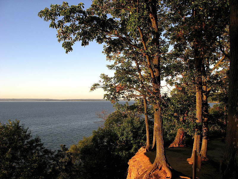
La première ligne, de gauche à droite: Sandy Point State Park, sur Cheseapeake Bay près de Annapolis, Maryland, avec le pont (Bay Bridge) dans la derrière; Elk Neck State Park, Cheseapeake Bay, le nord-est de Maryland près à l’état Delaware; Turkey Point Lighthouse, Elk Neck State Park, sur Cheseapeake Bay, Maryland.

La deuxième ligne, de gauche à droite: Chesapeake Bay, Elk Neck State Park, Maryland; Cheseapeake Bay de Elk Neck State Park; Assateague Island (le cote de Virginia).

La troixième ligne: Assateague Island (le côté de Maryland), un cheval native a l’Assateague.

Remarquez: les chevaux sur Assateague Island sont uniques, et se trouvent seulement sur cette islande.  On ne sait pas,  comment il sont arrivés la et d’ou ils sont venus!

Le Ski Nordique

Dans mon opinion, le ski nordique est le sport d’hivers idéale, et je l’aime plus que le ski alpine.  Le ski nordique combine les meilleures éléments du ski et d’alpinisme, et je trouve le ski nordique plus facile que le ski parce que j’ai peur d’etre trop en haut, et avec le ski nordique j’ai cette problème moins que avec le ski alpine.  Quand on sait comment se mouver sur les skis, on peut mouver plus vitement et efficientment que seulement sur les pieds, et on peut couvrer beaucoup de terraine.  Les photos ici sont de Canaan Valley, West Virginia, une des meillures locales aller pour faire le ski nordique dans ma region.

My friend Mason Callejas putting on his cross-country skis, at Whitegrass, in Davis, West Virginia, December 2008.
Close
My friend Mason Callejas putting on his cross-country skis, at Whitegrass, in Davis, West Virginia, December 2008.07-Dec-2008 12:58, Canon Canon PowerShot G9, 4.0, 7.4mm, 0.002 sec, ISO 100
Cross-Country skiing at Whitegrass, Davis, West Virginia.
Close
Cross-Country skiing at Whitegrass, Davis, West Virginia.07-Dec-2008 13:17, Canon Canon PowerShot G9, 5.0, 7.4mm, 0.001 sec, ISO 100
 
Cross-Country ski trail at Whitegrass, near Davis, West Virginia.
Close
Cross-Country ski trail at Whitegrass, near Davis, West Virginia.07-Dec-2008 14:20, Canon Canon PowerShot G9, 4.0, 7.4mm, 0.001 sec, ISO 80
Snowscape at Whitegrass Cross Country Ski Area, near Davis, West Virginia.
Close
Snowscape at Whitegrass Cross Country Ski Area, near Davis, West Virginia.07-Dec-2008 14:19, Canon Canon PowerShot G9, 4.5, 7.4mm, 0.001 sec, ISO 80
 

La première ligne, de gauche à droite: Mon ami Mason Callejas met les skis avant d’entrer la piste; La vue de la place de stationnement du chalet en bas de la montagne, de la piste.

La deuxième ligne: Sur la piste en Whitegrass; La vue panoramique de la piste en Whitegrass.

Voici video de mon ami Mason Callejas, de la fois que nous sommes allés ensembles faire le ski nordique dans decembre 2008.

Si vous voulez faire le ski nordique ou faire l’alpinisme avec moi,  contactez à moi, s’il vous plaît!  J’ai plus de photos et videos de l’alpinisme et nature dans mes galleries de YouTube, Google Picasa, et Ipernity.  Vous pouvez aussi voir les galleries de Picasa et Ipernity comme  présentations de diapositives, si vous voulez.

Leave a Reply

Your email address will not be published. Required fields are marked *

This site uses Akismet to reduce spam. Learn how your comment data is processed.